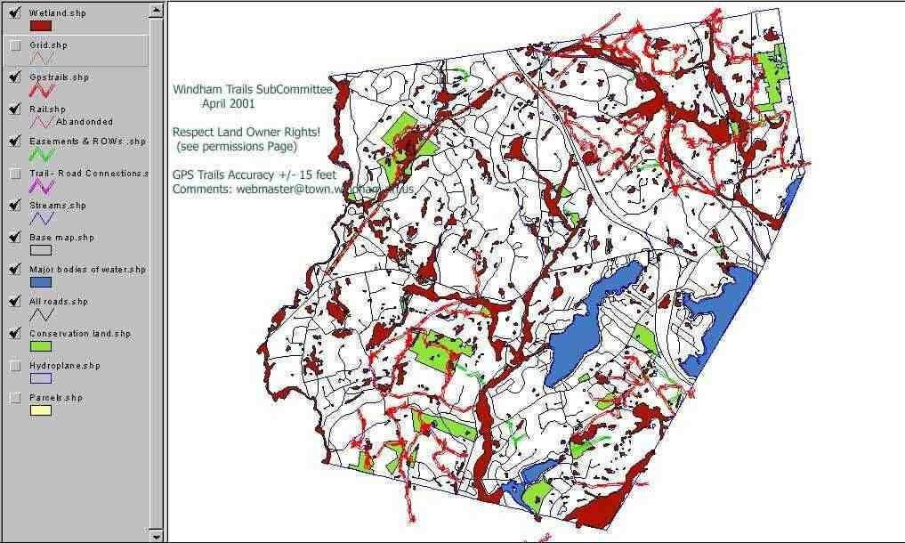
Windham Trail Network
Produced in 2001 by the Trails Committee (a Planning Board sub-committee) utilizing a handheld GPS device accurate to +/- 15':
- Tim Schreiner - Digital data collector and Cartographer
- Wayne Morris - Member Planning Board and Analog data collector
- Ross McLeod - Member Planning Board and Conservation Commission
Also available on line is a partial representation of Windham's Trail Network. These maps were created in April 2001, by Tim Schreiner, digital data collector and cartographer, Wayne Morris, Conservation Commission member and analog data collector and Ross McLeod, Board of Selectman member and former member of the Conservation Commission. Also available, is a 1998 PDF version of the "Walking in Windham" booklet.
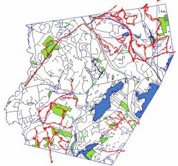
| North West | North Central | North East |
| Central West | Mid-Central | Central East |
| South West | South Central | South East |
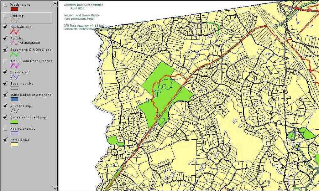
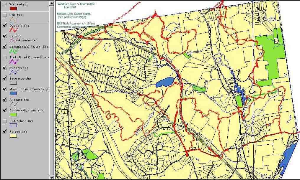
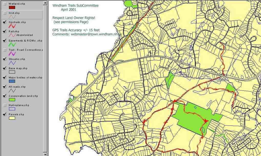
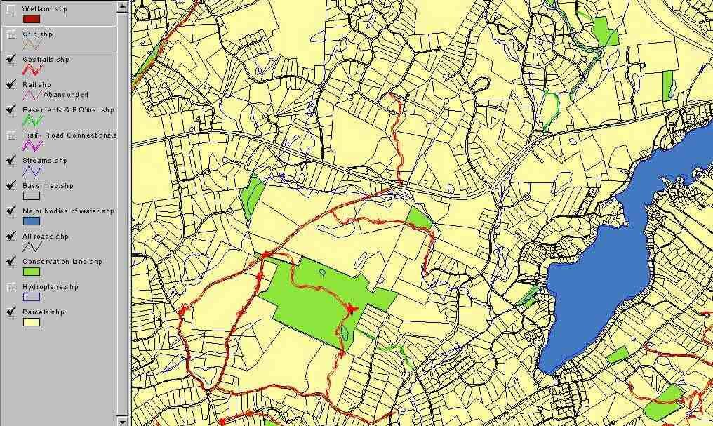
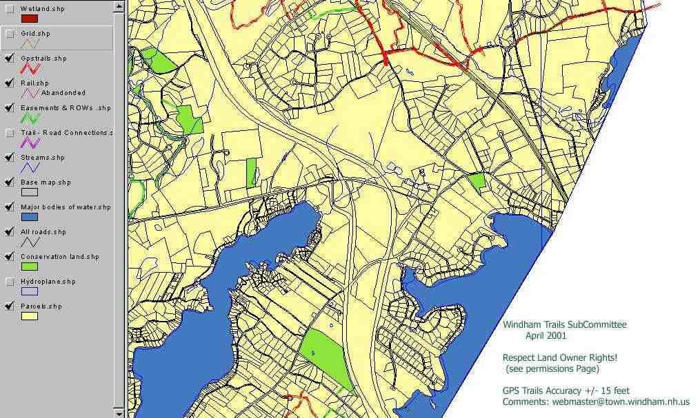
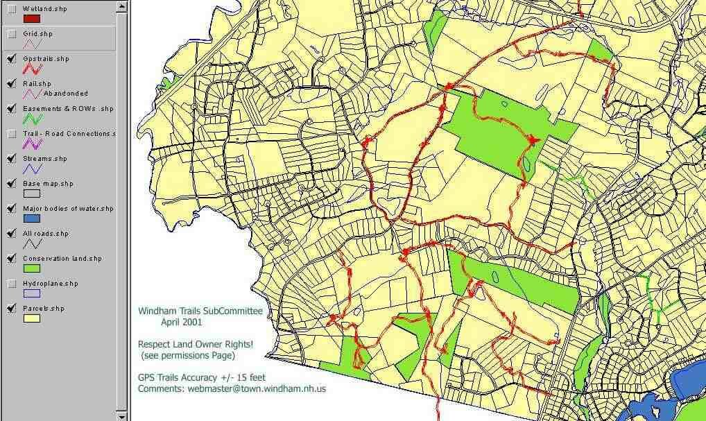
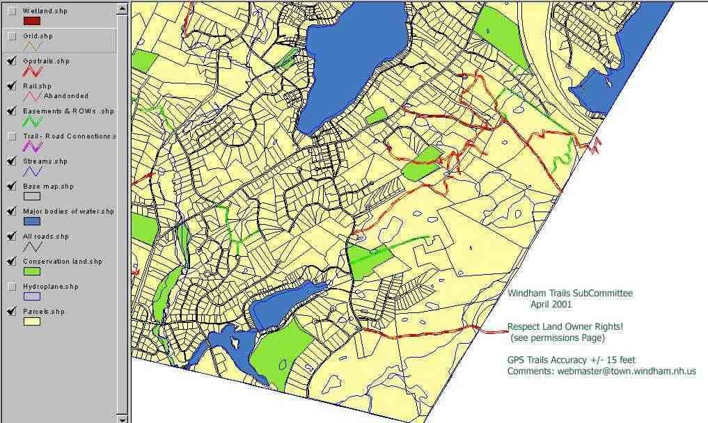
LEGEND DETAILS
- GPS Trails - Woodland roads, and trails collected via handheld GPS device.
- Trail Road Connections - Roads that connect major trail regions.
- Rail - Abandoned railroad beds.
- Easements & ROWS - Town Easements and Rights-of-Way
- Wetlands - Wetland areas.
- Streams - Streams.
- Base Map - The Town boundary.
- Major Bodies of Water - The Great Ponds of Windham .
- All Roads - State, Town and Private roads.
- Conservation Land - These are the Town owned lands.
- Hydroplane -
- Parcels - Property outlines.
PERMISSIONS (Land Owner Rights)
On all maps, town owned land is indicated in green areas. Rights of way and easements exist as green lines. On these lands the public has the right to pass.
Many of the trails listed on these maps exist as "Discontinued roads". Where these interconnecting discontinued roads abut town-owned land, they are available as a right-of-way for all townspeople to enjoy. Where private lands abut these discontinued roads abutting land-owners have a right of way. Where the trails or discontinued roads exist on private land, remember to ask permission of the land owner.
The list of discontinued roads in Windham include the following. Those marked with an *, denotes that the town (public) has right to pass over these roads. All others are owned by the abutters.
- Johnny Hill Road
- Parker Road
- Bridle Bridge Road
- Morrison Road
- Butterfield Rock Road
- Haskell Road
- Dark Entry Road
- London Bridge Road *
- Spear Hill Road *
- Governor Dinsmore Road *
- Bissel Camp Road *
- Witch Hazel Road *
- Pine Hill Road *
- Country Road *
- Hopkins Road *
ALSO SEE